
The APMAG team met with Glenville representatives to get an update on the monitoring of the subsidence and erosion of the Alphington Yarra riverfront.
Glenville have installed monitors across the site, in pits and the riverfront itself, to track data. The monitors track water levels, as well as the chemical composition of the water and volume of flow. The data will be used to test and build on the investigations done late last year by external experts, Alluvium.

The Riverfront monitoring results will also be available to the arborist on the project who is watching the health of the trees being impacted. A report on the findings is also being reviewed by council now and is expected to be public soon.
Recent work to seal sediment ponds, construct ag drainage, Mills Boulevard and install main stormwater infrastructure is expected to have helped.
The next report is expected in December.
Between then and now, more road surface & guttering will be sealed, basement construction and pumping finished and more stormwater piping brought online, which is also expected to improve stormwater management.
The river path is not open, and Glenville does not know when it will be safe to re-open the path. The result of monitoring will be the big determinant in estimating when it will be safe again.
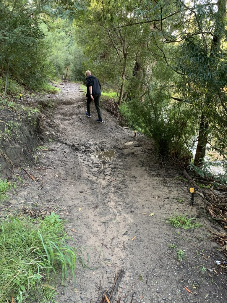
I am perplexed that the watercourse running through the site, shown on old maps & later called the Woodlands drain, should cause so many problems when all drainage issues should have been planned for. How can this issue become so problematic? As well, which datum will be used for the river front set back for buildings? The old datum, where the line of the bank is now in the water, or the new datum, the current bank? I would just like my path restored right now, not at some vaguely distant future date.